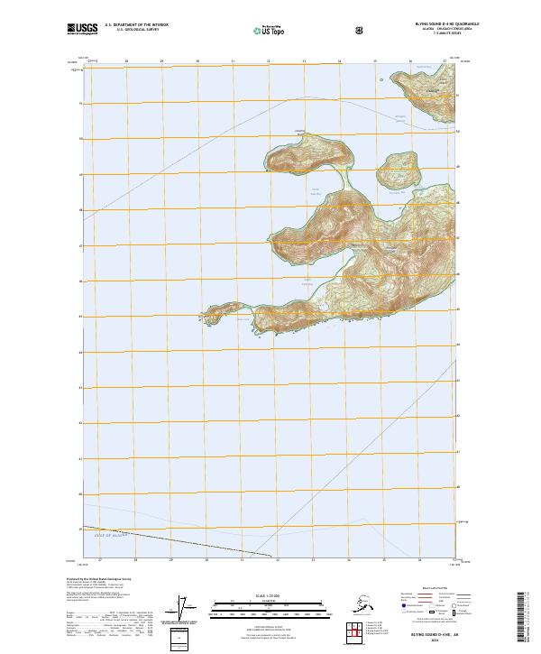
2024 Map of Blying Sound D-4 NE
USGS Topo · Published 2024About this map
Evans Island and Elrington Island dominate this coastal survey of the Prince William Sound region, where steep island topography meets the open Gulf of Alaska. The settlement of Chenega is situated on the northeastern tip of Evans Island, overlooking the waters of Squirrel Bay. This area of the Chugach National Forest is defined by a complex maritime geography of sheltered inlets and exposed capes, including the deep indentations of North Twin Bay and South Twin Bay. The map traces the natural corridor of Elrington Passage, a vital waterway separating the major landmasses. The southern reaches of the map terminate at Point Elrington, where the land drops away into the open gulf. This modern survey provides an exact record of the shoreline and elevation contours for these remote islands, from the tidal flats of Koss Cove to the high ridges above Fox Farm Bay.
Find a feature on this map
17 named features on this map. Tap any name to fly to it.
Don’t see what you’re looking for? This feature index may not catch every label — zoom into the map to look around manually.
Map Details
Editions of this 2024 Blying Sound D-4 NE Map
This is the sole edition of this map. No revisions or reprints were ever made.
Other maps of this area

1946 · Blying Sound
USGS Topo · 1:250,000

1950 · Blying Sound D-4
USGS Topo · 1:63,360

1951 · Blying Sound
USGS Topo · 1:250,000

1951 · Seward
USGS Topo · 1:250,000

1951 · Seward A-3
USGS Topo · 1:63,360

1951 · Seward A-4
USGS Topo · 1:63,360

1952 · Seward A-3
USGS Topo · 1:63,360

1952 · Seward A-4
USGS Topo · 1:63,360
1952 · Blying Sound D-4
USGS Topo · 1:63,360
1953 · Blying Sound D-3
USGS Topo · 1:63,360