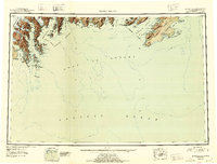
1946 Map of Blying Sound
USGS Topo · Published 1954About this map
The Kenai Mountains meet the sea in this mid-century survey of the Kenai Peninsula coast, where the massive Harding Ice Field feeds a series of tidewater glaciers. The map details the complex shoreline of Resurrection Bay and Aialik Bay, documenting the positions of the Aialik Glacier, Pederson Glacier, and Holgate Glacier. To the east, the survey encompasses the entrance to Prince William Sound, including Montague Island and Latouche Island within the Chugach National Forest. This 1940s record of the coast preserves the original maritime nomenclature of the Gulf of Alaska before modern environmental shifts altered these ice fronts. It provides a foundational view of the region's geography, tracing the deep fjords and islands such as Granite Island and the Chiswell Is that define this glaciated maritime landscape.
Find a feature on this map
67 named features on this map. Tap any name to fly to it.
Don’t see what you’re looking for? This feature index may not catch every label — zoom into the map to look around manually.
Map Details
Editions of this 1946 Blying Sound Map
2 editions found
Other maps of this area

1944 · Kenai
USGS Topo · 1:250,000

1946 · Blying Sound
USGS Topo · 1:250,000

1948 · Cordova
USGS Topo · 1:250,000

1948 · Middleton Island
USGS Topo · 1:250,000

1950 · Kenai
USGS Topo · 1:250,000

1950 · Middleton Island
USGS Topo · 1:250,000

1950 · Seward A-6
USGS Topo · 1:63,360

1950 · Seward A-8
USGS Topo · 1:63,360

1950 · Blying Sound D-7
USGS Topo · 1:63,360

1950 · Blying Sound D-6
USGS Topo · 1:63,360