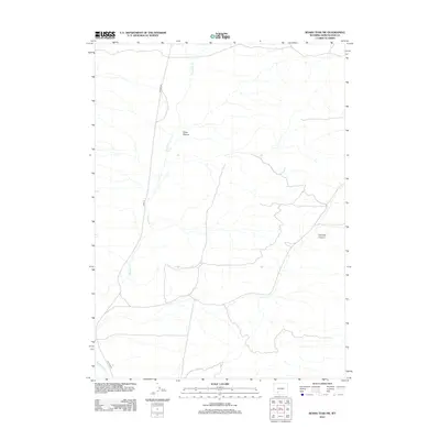
2012 Map of Boars Tusk SW
USGS Topo · Published 2012About this map
Killpecker Cr defines the drainage of this arid Sweetwater County landscape, flowing southward through a network of desert washes and seasonal stream beds. The terrain is marked by significant topographical shifts as evidenced by Cedar Canyon and Crooked Canyon, which reveal the erosive history of the high Wyoming plains. Human presence is light and primarily represented by transportation corridors, with Chilton Rd and Co Rd-17 providing the primary access points through this remote section of the Red Desert. This 2012 survey captures the area during a period of modern geospatial mapping, documenting the intersection of natural drainage patterns and the rural road network that serves the region's energy and ranching interests.
Find a feature on this map
5 named features on this map. Tap any name to fly to it.
Don’t see what you’re looking for? This feature index may not catch every label — zoom into the map to look around manually.
Map Details
Editions of this 2012 Boars Tusk SW Map
This is the sole edition of this map. No revisions or reprints were ever made.
Other maps of this area

1908 · Rock Springs
USGS Topo · 1:62,500

1910 · Rock Springs
USGS Topo · 1:62,500

1954 · Rock Springs
USGS Topo · 1:250,000

1958 · Rock Springs
USGS Topo · 1:250,000

1958 · Boars Tusk
USGS Topo · 1:62,500

1961 · Pilot Butte
USGS Topo · 1:24,000

1962 · Rock Springs
USGS Topo · 1:250,000

1968 · North Baxter
USGS Topo · 1:24,000

1968 · White Rocks
USGS Topo · 1:24,000
1968 · Clay Buttes SE
USGS Topo · 1:24,000