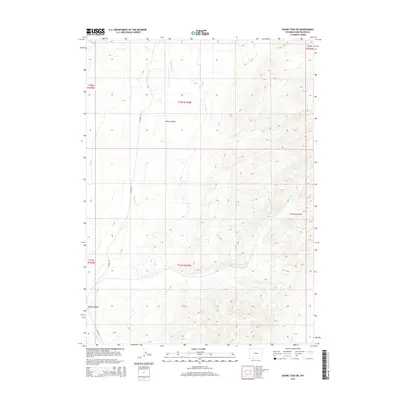
2015 Map of Boars Tusk SW
USGS Topo · Published 2015About this map
Killpecker Cr winds through this high-desert terrain of Sweetwater County, shaping the drainage patterns that define the local geography. The landscape is marked by significant topographical shifts, most notably within Cedar Canyon, Crooked Canyon, and Long Canyon. These deep-cut features are essential landmarks for understanding the area's natural boundaries and water flow. Human presence in this section of the Red Desert is primarily indicated by Chilton Rd, a local connector providing access through the various township and range sections including t22n r104w and t21n r104w. The map preserves the specific legal land descriptions used for ranching and resource management in this part of Wyoming during the early twenty-first century.
Find a feature on this map
10 named features on this map. Tap any name to fly to it.
Don’t see what you’re looking for? This feature index may not catch every label — zoom into the map to look around manually.
Map Details
Editions of this 2015 Boars Tusk SW Map
This is the sole edition of this map. No revisions or reprints were ever made.
Other maps of this area

1908 · Rock Springs
USGS Topo · 1:62,500

1910 · Rock Springs
USGS Topo · 1:62,500

1954 · Rock Springs
USGS Topo · 1:250,000

1958 · Rock Springs
USGS Topo · 1:250,000

1958 · Boars Tusk
USGS Topo · 1:62,500

1961 · Pilot Butte
USGS Topo · 1:24,000

1962 · Rock Springs
USGS Topo · 1:250,000

1968 · North Baxter
USGS Topo · 1:24,000

1968 · White Rocks
USGS Topo · 1:24,000
1968 · Clay Buttes SE
USGS Topo · 1:24,000