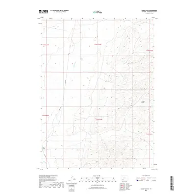
2017 Map of Boars Tusk SW
USGS Topo · Published 2017About this map
Killpecker Cr winds through the high desert landscape of Sweetwater County, shaping the drainage patterns and topographical relief of this arid region. The terrain is defined by dramatic erosional features, including the distinct formations of Cedar Canyon in the north and the winding Crooked Canyon to the east. These landforms, along with Long Canyon in the southwest, characterize the remote and unpopulated character of the area during the early twenty-first century. Human presence is evidenced primarily by utility and transport corridors such as Chilton Rd and Co Rd 17, which provide access through the vast open spaces between established townships. The map documents a landscape of sparse water sources and complex land management boundaries across the township and range survey lines of the high plains.
Find a feature on this map
12 named features on this map. Tap any name to fly to it.
Don’t see what you’re looking for? This feature index may not catch every label — zoom into the map to look around manually.
Map Details
Editions of this 2017 Boars Tusk SW Map
This is the sole edition of this map. No revisions or reprints were ever made.
Other maps of this area

1908 · Rock Springs
USGS Topo · 1:62,500

1910 · Rock Springs
USGS Topo · 1:62,500

1954 · Rock Springs
USGS Topo · 1:250,000

1958 · Rock Springs
USGS Topo · 1:250,000

1958 · Boars Tusk
USGS Topo · 1:62,500

1961 · Pilot Butte
USGS Topo · 1:24,000

1962 · Rock Springs
USGS Topo · 1:250,000

1968 · North Baxter
USGS Topo · 1:24,000

1968 · White Rocks
USGS Topo · 1:24,000
1968 · Clay Buttes SE
USGS Topo · 1:24,000