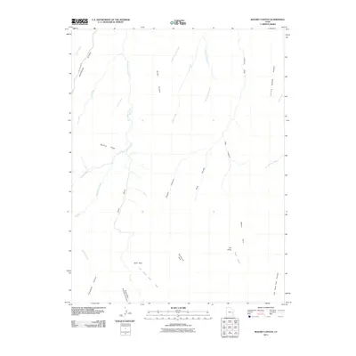
2011 Map of Bogart Canyon
USGS Topo · Published 2011About this map
Bogart Canyon and its complex network of seasonal drainages define this high-desert landscape in northeastern Grand County. At the start of the 21st century, the area remains dominated by prominent landforms such as Mormon Ridge and Went Ridge, which dictate the flow of the local watershed. Water, the primary architect of this terrain, is tracked through named features like West Willow Creek and Nash Wash. The map reveals a land utilized for more than just its geology, noting isolated sites like The Pines and Oak Springs. Unusual landmarks such as Hells Hole, Beaver Hole, and Surveyors Hole suggest a history of local nomenclature tied to the specific topography of the canyons. Transportation is minimal, with Sego Canyon Rd providing one of the few named access points into this intricate system of draws and gulches.
Find a feature on this map
30 named features on this map. Tap any name to fly to it.
Don’t see what you’re looking for? This feature index may not catch every label — zoom into the map to look around manually.
Map Details
Editions of this 2011 Bogart Canyon Map
This is the sole edition of this map. No revisions or reprints were ever made.
Other maps of this area

1885 · East Tavaputs
USGS Topo · 1:250,000

1956 · Grand Junction
USGS Topo · 1:250,000

1959 · Grand Junction
USGS Topo · 1:250,000

1960 · Grand Junction
USGS Topo · 1:250,000

1962 · Grand Junction
USGS Topo · 1:250,000

1963 · Tenmile Canyon
USGS Topo · 1:62,500

1963 · Moonwater Point
USGS Topo · 1:62,500
1963 · Floy Canyon
USGS Topo · 1:62,500

1963 · Sego Canyon
USGS Topo · 1:62,500

1964 · Grand Junction
USGS Topo · 1:250,000