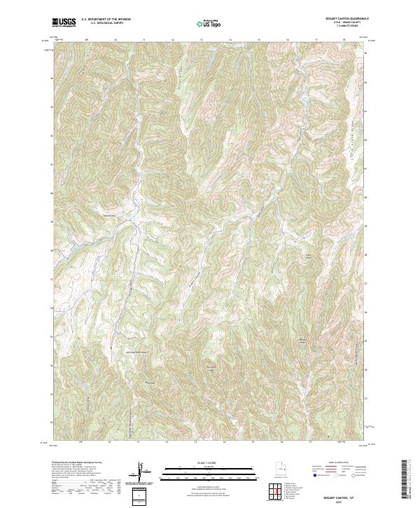
2023 Map of Bogart Canyon
USGS Topo · Published 2023About this map
Bogart Canyon and its complex drainage systems dominate this Grand County landscape, where deep watercourses like Nash Wash and Left Hand Nash Wash cut through the high plateau. The terrain is defined by prominent divides such as Mormon Ridge and Went Ridge, while smaller, strikingly named landmarks like Hells Hole, Surveyors Hole, and Beaver Hole offer specific points of interest for those tracking historical land use or surveying history in this section of Utah. A network of seasonal and permanent water sources, including Oak Springs and West Willow Creek, underscores the geographic importance of water management in this arid region. The topography revealed here is a study in verticality, transitioning from ridges and draws like Ballard Draw to the steep walls of She Canyon and Buck Canyon.
Find a feature on this map
28 named features on this map. Tap any name to fly to it.
Don’t see what you’re looking for? This feature index may not catch every label — zoom into the map to look around manually.
Map Details
Editions of this 2023 Bogart Canyon Map
This is the sole edition of this map. No revisions or reprints were ever made.
Other maps of this area

1885 · East Tavaputs
USGS Topo · 1:250,000

1956 · Grand Junction
USGS Topo · 1:250,000

1959 · Grand Junction
USGS Topo · 1:250,000

1960 · Grand Junction
USGS Topo · 1:250,000

1962 · Grand Junction
USGS Topo · 1:250,000

1963 · Tenmile Canyon
USGS Topo · 1:62,500

1963 · Moonwater Point
USGS Topo · 1:62,500
1963 · Floy Canyon
USGS Topo · 1:62,500

1963 · Sego Canyon
USGS Topo · 1:62,500

1964 · Grand Junction
USGS Topo · 1:250,000