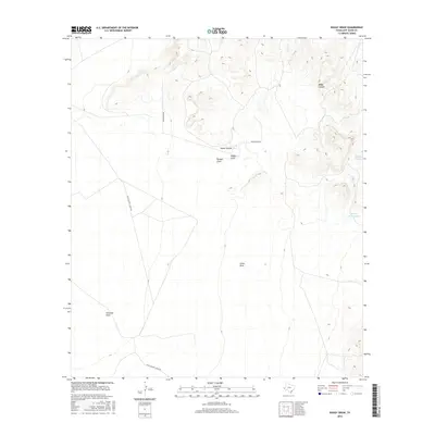
2016 Map of Boggy Draw
USGS Topo · Published 2016About this map
Helm Ranch Rd and Agua Calient Lodge Rd trace the sparse human footprint across this arid Jeff Davis County landscape. The terrain is defined by a series of drainage systems, including the central Boggy Draw and Bunton Draw, which converge near Lucky Tank. These water features, alongside Dinkins Tank and String Bean Tank, suggest the vital importance of water management in this high-desert ranching environment. To the northeast, the topography becomes more complex at Boggy Canyon, where elevation contours tighten significantly compared to the broad, sweeping valleys of Jones Draw and Ninemile Draw. This map preserves the 2016 arrangement of private ranch roads and named catchments that have long dictated the movement of livestock and people through the Trans-Pecos region.
Find a feature on this map
10 named features on this map. Tap any name to fly to it.
Don’t see what you’re looking for? This feature index may not catch every label — zoom into the map to look around manually.
Map Details
Editions of this 2016 Boggy Draw Map
This is the sole edition of this map. No revisions or reprints were ever made.
Other maps of this area

1892 · Chispa
USGS Topo · 1:125,000

1894 · Valentine
USGS Topo · 1:125,000

1895 · Chispa
USGS Topo · 1:125,000

1897 · Valentine
USGS Topo · 1:125,000

1897 · Chispa
USGS Topo · 1:125,000

1943 · Valentine
USGS Topo · 1:125,000

1959 · Marfa
USGS Topo · 1:250,000

1965 · Marfa
USGS Topo · 1:250,000
1978 · Bare Mountain
USGS Topo · 1:24,000
1978 · Herds Pass
USGS Topo · 1:24,000