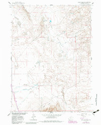
1960 Map of Boggy Meadows
USGS Topo · Published 1986About this map
Boggy Meadows defines this portion of the Missouri River Basin development area, characterized by a series of high desert basins and drainages. The landscape is punctuated by the Boggy Meadows Lake and the prominent Boggy Meadows Rim to the northwest. Water is a defining scarce resource here, evidenced by labels for a solitary Spring and the seasonal courses of Stone Creek and Separation Creek.
Find a feature on this map
10 named features on this map. Tap any name to fly to it.
Don’t see what you’re looking for? This feature index may not catch every label — zoom into the map to look around manually.
Map Details
Editions of this 1960 Boggy Meadows Map
2 editions found
Other maps of this area

1953 · Ferris
USGS Topo · 1:24,000

1953 · Riddle Cut
USGS Topo · 1:24,000

1953 · Rawlins NW
USGS Topo · 1:24,000

1954 · Rawlins
USGS Topo · 1:250,000

1955 · Casper
USGS Topo · 1:250,000

1956 · Rawlins Peak
USGS Topo · 1:62,500

1958 · Rawlins
USGS Topo · 1:250,000

1958 · Casper
USGS Topo · 1:250,000

1960 · Separation Rim
USGS Topo · 1:24,000

1960 · Boggy Meadows
USGS Topo · 1:24,000