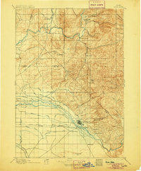
1897 Map of Boise
USGS Topo · Published 1905About this map
Boise serves as the focal point of this late 19th-century survey, surrounded by an extensive network of irrigation infrastructure critical to the development of the Treasure Valley. The city itself is marked by distinctive landmarks such as the Boise Barracks and the Natatorium, while the Boise River is flanked by a complex system of waterways including the Middleton Mill Canal, Eureka Canal, and Ridenbaugh Canal. These features highlight the early engineering efforts to reclaim the semi-arid landscape for agriculture.
Find a feature on this map
73 named features on this map. Tap any name to fly to it.
Don’t see what you’re looking for? This feature index may not catch every label — zoom into the map to look around manually.
Map Details
Editions of this 1897 Boise Map
4 editions found
Other maps of this area

1892 · Mountain Home
USGS Topo · 1:125,000

1892 · Boise
USGS Topo · 1:125,000

1892 · Bisuka
USGS Topo · 1:125,000

1892 · Silver City
USGS Topo · 1:125,000

1893 · Mountain Home
USGS Topo · 1:125,000

1894 · Bisuka
USGS Topo · 1:125,000

1894 · Silver City
USGS Topo · 1:125,000

1894 · Squaw Creek
USGS Topo · 1:125,000

1894 · Idaho Basin
USGS Topo · 1:125,000

1897 · Boise
USGS Topo · 1:125,000