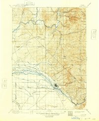
1897 Map of Boise
USGS Topo · Published 1948About this map
Boise and its immediate surroundings are depicted here during a period of significant agricultural and infrastructure development in the late 19th century. The irrigation landscape is particularly prominent, with an intricate network of waterworks including the Farmers Union Canal, Ballentine Canal, and Middleton Canal feeding the fertile lands around Eagle Island. To the north, the terrain rises into the Boise National Forest, marked by landmarks such as Shafer Butte and the early mining camp of Pearl.
Find a feature on this map
90 named features on this map. Tap any name to fly to it.
Don’t see what you’re looking for? This feature index may not catch every label — zoom into the map to look around manually.
Map Details
Editions of this 1897 Boise Map
4 editions found
Other maps of this area

1892 · Mountain Home
USGS Topo · 1:125,000

1892 · Boise
USGS Topo · 1:125,000

1892 · Bisuka
USGS Topo · 1:125,000

1892 · Silver City
USGS Topo · 1:125,000

1893 · Mountain Home
USGS Topo · 1:125,000

1894 · Bisuka
USGS Topo · 1:125,000

1894 · Silver City
USGS Topo · 1:125,000

1894 · Squaw Creek
USGS Topo · 1:125,000

1894 · Idaho Basin
USGS Topo · 1:125,000

1897 · Boise
USGS Topo · 1:125,000