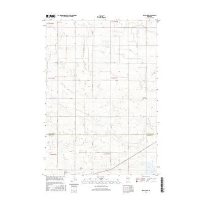
2016 Map of Boise Lake
USGS Topo · Published 2016About this map
The border of Redwood and Brown counties bisects this agricultural landscape in southern Minnesota, where a systematic grid of section roads defines the rural character. The terrain is marked by gentle depressions and watercourses, most notably Sleepy Eye Creek which winds through the western sections, and the small basin of Boise Lake in the southeast. For those researching local families, the presence of three distinct burial sites—Dannebod Cem, Saint Paul Cem, and Saint Rachael Cem—provides significant points of reference for the surrounding townships. The road network, including thoroughfares like Co Rd 13 and Co Rd 69, reflects the late 20th-century development of the region's transportation infrastructure serving the local farming economy.
Find a feature on this map
26 named features on this map. Tap any name to fly to it.
Don’t see what you’re looking for? This feature index may not catch every label — zoom into the map to look around manually.
Map Details
Editions of this 2016 Boise Lake Map
This is the sole edition of this map. No revisions or reprints were ever made.
Other maps of this area

1953 · Morgan
USGS Topo · 1:62,500

1953 · New Ulm
USGS Topo · 1:250,000

1957 · New Ulm
USGS Topo · 1:250,000

1958 · New Ulm
USGS Topo · 1:250,000

1967 · New Ulm
USGS Topo · 1:250,000

1967 · Clements
USGS Topo · 1:24,000

1967 · Clements SE
USGS Topo · 1:24,000

1967 · Springfield
USGS Topo · 1:24,000

1967 · Sanborn NE
USGS Topo · 1:24,000
1967 · Leavenworth
USGS Topo · 1:24,000