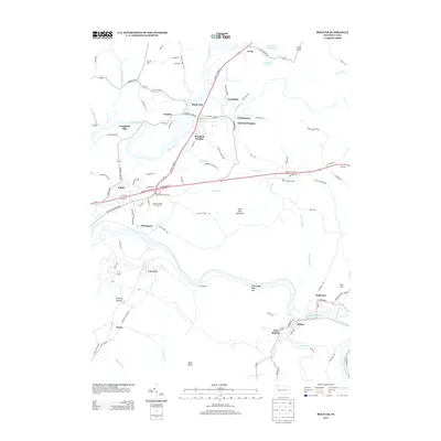
2013 Map of Bolivar
USGS Topo · Published 2013About this map
Black Lick and Josephine sit at the northern reaches of this landscape, where the confluence of Blacklick Cr and Two Lick Cr once served as a primary corridor for transportation and industry. The terrain is defined by the massive ridge of Penn View Mountain and Chestnut Ridge, separated by the dramatic Conemaugh Water Gap. This natural pass facilitates the flow of the Conemaugh River, which anchors the southern settlements of Bolivar, West Bolivar, and Robinson. Small industrial and residential enclaves such as McCrea Row and Dixon Row appear alongside larger established communities, indicating the localized settlement patterns typical of the region's mining and milling history. Notable landmarks like the Penn View Lookout Tower and the deep cut of Tannery Hollow highlight the transition from valley floors to the high elevations of Bear Rocks.
Find a feature on this map
102 named features on this map. Tap any name to fly to it.
Don’t see what you’re looking for? This feature index may not catch every label — zoom into the map to look around manually.
Map Details
Editions of this 2013 Bolivar Map
This is the sole edition of this map. No revisions or reprints were ever made.
Other maps of this area

1900 · Latrobe
USGS Topo · 1:62,500

1902 · Latrobe
USGS Topo · 1:62,500

1902 · Indiana
USGS Topo · 1:62,500

1902 · Elders Ridge
USGS Topo · 1:62,500

1903 · Latrobe
USGS Topo · 1:62,500

1904 · Elders Ridge
USGS Topo · 1:62,500

1920 · New Florence
USGS Topo · 1:62,500

1921 · New Florence
USGS Topo · 1:48,000

1922 · New Florence
USGS Topo · 1:62,500

1944 · New Florence
USGS Topo · 1:62,500
Featured Places
- Brush Valley Township, PA
- Black Lick Township, PA
- Bolivar, PA
- Fairfield Township, PA
- Burrell Township, PA