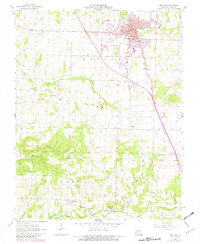
1961 Map of Bolivar
USGS Topo · Published 1982About this map
Bolivar serves as the focal point of this Polk County landscape, showing the town's layout and expansion as captured in the early 1960s with updates into the early 1980s. The Burlington Northern railroad corridor cuts through the terrain, connecting the larger settlement of Bolivar to smaller rural communities like Karlin and Wishart to the south. This area is defined by its network of watercourses, including the winding Bear Creek and Walnut Creek, which likely shaped the early settlement patterns and agricultural development of the region.
Find a feature on this map
15 named features on this map. Tap any name to fly to it.
Don’t see what you’re looking for? This feature index may not catch every label — zoom into the map to look around manually.
Map Details
Editions of this 1961 Bolivar Map
2 editions found
Other maps of this area

1884 · Springfield
USGS Topo · 1:125,000

1884 · Bolivar
USGS Topo · 1:125,000

1886 · Stockton
USGS Topo · 1:125,000

1886 · Greenfield
USGS Topo · 1:125,000

1886 · Springfield
USGS Topo · 1:125,000

1888 · Greenfield
USGS Topo · 1:125,000

1892 · Bolivar
USGS Topo · 1:125,000

1950 · Polk
USGS Topo · 1:24,000

1950 · Cliquot
USGS Topo · 1:24,000
1951 · Cliquot
USGS Topo · 1:24,000