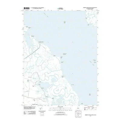
2011 Map of Bombay Hook Island
USGS Topo · Published 2011About this map
Bombay Hook Wildlife Refuge dominates this coastal landscape where the Delaware River meets a labyrinth of tidal guts and salt marshes. The settlement of Woodland Beach sits along the shoreline at the terminus of Delaware Ave, while further south, the managed impoundments of Bear Swamp Pool, Shearness Pool, and Raymond Pool illustrate the area's transition into a protected sanctuary. Waterways such as Duck Creek, Sluice-Ditch, and Slooch Ditch carve through the wetlands, creating isolated landmasses like Collins Island and Georges Island. Navigation is a central theme of this littoral zone, anchored by the iconic Ship John Shoal Light standing offshore. Local history is preserved in the naming of coastal landmarks like Whitehall Neck and Dutch Neck, alongside small landings such as Whitehall Landing that once served the remote agricultural and maritime interests of the Delaware bayside.
Find a feature on this map
51 named features on this map. Tap any name to fly to it.
Don’t see what you’re looking for? This feature index may not catch every label — zoom into the map to look around manually.
Map Details
Editions of this 2011 Bombay Hook Island Map
This is the sole edition of this map. No revisions or reprints were ever made.
Other maps of this area

1890 · Bay Side
USGS Topo · 1:62,500

1894 · Bay Side
USGS Topo · 1:62,500

1899 · Vineland
USGS Topo · 1:125,000

1899 · Dover
USGS Topo · 1:125,000

1906 · Dover
USGS Topo · 1:125,000

1919 · Vineland
USGS Topo · 1:125,000

1920 · Dover
USGS Topo · 1:125,000

1926 · Wyoming
USGS Topo · 1:48,000

1930 · Wyoming
USGS Topo · 1:62,500

1931 · Wyoming
USGS Topo · 1:62,500