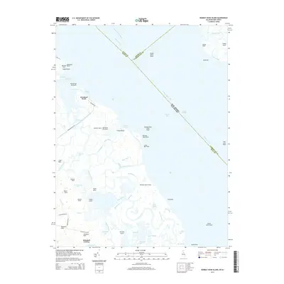
2014 Map of Bombay Hook Island
USGS Topo · Published 2014About this map
Woodland Beach sits along the tidal edge of the Delmarva Peninsula, where the Delaware River meets the expansive salt marshes of Bombay Hook Island. This 2014 survey documents a complex hydrological landscape defined by countless guts, ditches, and sloughs, including Mikes Ditch, Shearness Gut, and Matty Ditch. The network of man-made and natural waterways illustrates the historical effort to manage this coastal environment, seen in the Dutch Neck Canal and the drainage lines surrounding Raymond Pool and Bear Swamp Pool. Along the river’s main channel, maritime safety is noted by the Liston Range and the Ship John Shoal. Inland, small landings and points like Whitehall Landing, Parson Point, and Collins Island provide evidence of local land divisions and family-named landmarks that have persisted along the Leipsic River.
Find a feature on this map
74 named features on this map. Tap any name to fly to it.
Don’t see what you’re looking for? This feature index may not catch every label — zoom into the map to look around manually.
Map Details
Editions of this 2014 Bombay Hook Island Map
This is the sole edition of this map. No revisions or reprints were ever made.
Other maps of this area

1890 · Bay Side
USGS Topo · 1:62,500

1894 · Bay Side
USGS Topo · 1:62,500

1899 · Vineland
USGS Topo · 1:125,000

1899 · Dover
USGS Topo · 1:125,000

1906 · Dover
USGS Topo · 1:125,000

1919 · Vineland
USGS Topo · 1:125,000

1920 · Dover
USGS Topo · 1:125,000

1926 · Wyoming
USGS Topo · 1:48,000

1930 · Wyoming
USGS Topo · 1:62,500

1931 · Wyoming
USGS Topo · 1:62,500