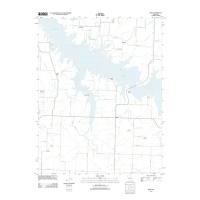
2011 Map of Bona
USGS Topo · Published 2011About this map
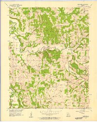
Stockton Lake dominates this portion of Dade County, its irregular shoreline reaching into the Missouri landscape to create prominent features like Perkins Bluff and Tunnel Bluff. The reservoir's influence is clear, having altered the drainage patterns of Mutton Creek and Maze Creek, while the Baird Lake Dam regulates the waters of Baird Lake to the north. Despite the expansion of the lake, the rural character of the area persists through small settlements such as Bona, Cane Hill, and Needmore. For those researching local families, the map is particularly detailed, locating several burial grounds including Asbell Cemetery, Fullington Cemetery, and Neil Cemetery. The intersection of nature and infrastructure is highlighted by Stockton State Park and the network of county roads that navigate the water-bound terrain.
Find a feature on this map
63 named features on this map. Tap any name to fly to it.
Don’t see what you’re looking for? This feature index may not catch every label — zoom into the map to look around manually.
Map Details
Editions of this 2011 Bona Map
This is the sole edition of this map. No revisions or reprints were ever made.
Other maps of this area

1886 · Stockton
USGS Topo · 1:125,000

1886 · Greenfield
USGS Topo · 1:125,000

1888 · Greenfield
USGS Topo · 1:125,000

1954 · Springfield
USGS Topo · 1:250,000

1955 · Dadeville
USGS Topo · 1:24,000
1956 · Fair Play
USGS Topo · 1:24,000
1956 · Walnut Grove
USGS Topo · 1:24,000
1956 · Stockton
USGS Topo · 1:24,000
1956 · Bearcreek
USGS Topo · 1:24,000

1956 · Greenfield
USGS Topo · 1:24,000