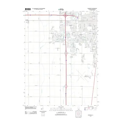
2012 Map of Bondville
USGS Topo · Published 2012About this map
Bondville and the western edge of the Champaign-Urbana metropolitan area are captured here in the early 21st century. The landscape transitions from the grid-like residential blocks of Kenwood and Savoy into the productive agricultural fields of Champaign County. Significant drainage and water management systems define the local geography, including the Copper Slough, Twomile Slough, and the Kaskaskia Ditch, which channel water through this prairie terrain. Cultural landmarks like the University of Illinois- Willard Airport and the Curtis Orchard And Pumpkin Patch stand alongside local community features such as Prairieview Cem. Residential growth is evident in suburban developments surrounding Maynard Lake and the Lincolnshire Fields Golf Course, illustrating the expanding footprint of the nearby university community into the surrounding countryside.
Find a feature on this map
162 named features on this map. Tap any name to fly to it.
Don’t see what you’re looking for? This feature index may not catch every label — zoom into the map to look around manually.
Map Details
Editions of this 2012 Bondville Map
This is the sole edition of this map. No revisions or reprints were ever made.
Other maps of this area

1906 · Urbana
USGS Topo · 1:62,500

1907 · Mahomet
USGS Topo · 1:62,500

1950 · Tuscola
USGS Topo · 1:62,500

1956 · Villa Grove
USGS Topo · 1:62,500

1957 · Urbana
USGS Topo · 1:62,500

1957 · Urbana
USGS Topo · 1:24,000

1957 · Rising
USGS Topo · 1:24,000

1957 · Mahomet
USGS Topo · 1:62,500

1957 · Bondville
USGS Topo · 1:24,000
1957 · Thomasboro
USGS Topo · 1:24,000