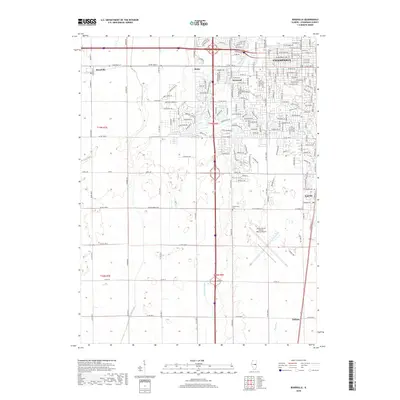
2018 Map of Bondville
USGS Topo · Published 2018About this map
Champaign and its western outskirts transition from dense urban street grids to the expansive agricultural landscape of central Illinois. The western edge of the city features residential developments like Kenwood and Staley, while the southern reaches are dominated by the significant footprint of the University of Illinois-Willard Airport. This interface between academic infrastructure and rural farmland is a defining characteristic of the region, where the organized grid of city streets gives way to long section-line roads such as Curtis Rd and W Old Church Rd.
Find a feature on this map
43 named features on this map. Tap any name to fly to it.
Don’t see what you’re looking for? This feature index may not catch every label — zoom into the map to look around manually.
Map Details
Editions of this 2018 Bondville Map
This is the sole edition of this map. No revisions or reprints were ever made.
Other maps of this area

1906 · Urbana
USGS Topo · 1:62,500

1907 · Mahomet
USGS Topo · 1:62,500

1950 · Tuscola
USGS Topo · 1:62,500

1956 · Villa Grove
USGS Topo · 1:62,500

1957 · Urbana
USGS Topo · 1:62,500

1957 · Urbana
USGS Topo · 1:24,000

1957 · Rising
USGS Topo · 1:24,000

1957 · Mahomet
USGS Topo · 1:62,500

1957 · Bondville
USGS Topo · 1:24,000
1957 · Thomasboro
USGS Topo · 1:24,000