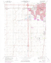
1975 Map of Bondville
USGS Topo · Published 1976About this map
Residential expansion and institutional development characterize the westward growth of Champaign during the mid-1970s. This survey illustrates the transformation of agricultural land into suburban neighborhoods like Kenwood and Savoy, marked by a dense concentration of local institutions including Kenwood Sch, South Side Sch, and the Greenbriar Manor Nursing Home. The southern portion of the sheet is dominated by the sprawling University of Illinois-Willard Airport, providing a clear record of the region's aviation infrastructure at the time.
Find a feature on this map
52 named features on this map. Tap any name to fly to it.
Don’t see what you’re looking for? This feature index may not catch every label — zoom into the map to look around manually.
Map Details
Editions of this 1975 Bondville Map
This is the sole edition of this map. No revisions or reprints were ever made.
Other maps of this area

1906 · Urbana
USGS Topo · 1:62,500

1907 · Mahomet
USGS Topo · 1:62,500

1950 · Tuscola
USGS Topo · 1:62,500

1956 · Villa Grove
USGS Topo · 1:62,500

1957 · Urbana
USGS Topo · 1:62,500

1957 · Urbana
USGS Topo · 1:24,000

1957 · Rising
USGS Topo · 1:24,000

1957 · Mahomet
USGS Topo · 1:62,500

1957 · Bondville
USGS Topo · 1:24,000
1957 · Thomasboro
USGS Topo · 1:24,000