
1974 Map of Bonetraill
USGS Topo · Published 1977About this map
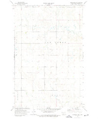
Gladys and Bonetraill anchor this section of northwestern North Dakota, where the open landscape is defined by drainage patterns and resource extraction. The map detail reflects a mid-1970s view of Williams County, showing the intermittent flow of Heidemann Coulee in the north and the more established path of Blacktail Creek as it feeds into Blacktail Lake. A dedicated Picnic Area on the lake's eastern shore suggests its role as a local recreational hub during this period.
Find a feature on this map
14 named features on this map. Tap any name to fly to it.
Don’t see what you’re looking for? This feature index may not catch every label — zoom into the map to look around manually.
Map Details
Editions of this 1974 Bonetraill Map
This is the sole edition of this map. No revisions or reprints were ever made.
Other maps of this area

1948 · Grenora
USGS Topo · 1:24,000

1948 · Hanks
USGS Topo · 1:24,000

1948 · Zahl
USGS Topo · 1:24,000

1953 · Williston
USGS Topo · 1:250,000

1957 · Williston
USGS Topo · 1:250,000

1974 · Blacktail Lake
USGS Topo · 1:24,000

1974 · Otter Tail Creek
USGS Topo · 1:24,000

1974 · West Bonetraill
USGS Topo · 1:24,000

1974 · Bonetraill SW
USGS Topo · 1:24,000
1974 · Bonetraill SE
USGS Topo · 1:24,000