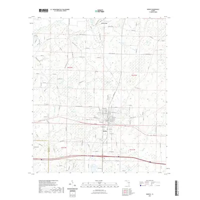
2021 Map of Bonifay
USGS Topo · Published 2021About this map
Bonifay serves as the focal point of this map, positioned at the crossing of major regional roads and home to the Holmes County Courthouse. The landscape surrounding the town is characterized by a complex network of shallow wetlands and seasonal basins known locally as bays, including Sand Path Bay, Lurkin Holland Bay, and the expansive Meetinghouse Bay. To the north, the settlement of Hoover Mill sits near the headwaters of Wrights Cr, reflecting the area's historical reliance on water-powered industry. The terrain is a mosaic of small drainage features like Gum Branch and Titi Br that feed into larger creeks. Genealogists may find interest in Still Cem and various family-named landmarks such as Tom Williams Bay and Pate Pond, which point to long-standing local land use and family holdings across the Florida Panhandle's pine-and-wetland interior.
Find a feature on this map
145 named features on this map. Tap any name to fly to it.
Don’t see what you’re looking for? This feature index may not catch every label — zoom into the map to look around manually.
Map Details
Editions of this 2021 Bonifay Map
This is the sole edition of this map. No revisions or reprints were ever made.
Other maps of this area

1949 · Hinsons Cross Roads
USGS Topo · 1:24,000

1949 · Caryville
USGS Topo · 1:24,000

1950 · Hinsons Cross Roads
USGS Topo · 1:24,000

1950 · Caryville
USGS Topo · 1:24,000

1950 · Izagora
USGS Topo · 1:24,000

1950 · Chipley
USGS Topo · 1:24,000

1950 · Wausau
USGS Topo · 1:24,000

1950 · Esto
USGS Topo · 1:24,000

1950 · Poplar Head
USGS Topo · 1:24,000

1951 · Graceville
USGS Topo · 1:24,000