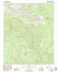
1987 Map of Bonita Meadows
USGS Topo · Published 1995About this map
Sequoia National Forest provides the backdrop for this high-elevation survey, centered on the operations of the Bonita Meadows Forest Ranger Sta and the Work Center located near the northeast corner. This 1980s landscape is defined by administrative and wilderness management, featuring a Visitor Information Sta (USFS) and a Radio Facility Heliport. The map illustrates the varied topography of the southern Sierra Nevada, from the prominent Beach Ridge to the drainages of Rattlesnake Creek and Trout Creek.
Find a feature on this map
28 named features on this map. Tap any name to fly to it.
Don’t see what you’re looking for? This feature index may not catch every label — zoom into the map to look around manually.
Map Details
Editions of this 1987 Bonita Meadows Map
3 editions found
Other maps of this area

1905 · Olancha
USGS Topo · 1:125,000

1905 · Fairview
USGS Topo · 1:24,000

1906 · Kernville
USGS Topo · 1:125,000

1907 · Olancha
USGS Topo · 1:125,000

1908 · Kernville
USGS Topo · 1:125,000

1918 · Fairview
USGS Topo · 1:31,680

1948 · Bakersfield
USGS Topo · 1:250,000

1948 · Fresno
USGS Topo · 1:250,000

1955 · Bakersfield
USGS Topo · 1:250,000

1955 · Fresno
USGS Topo · 1:250,000