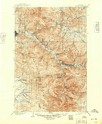
1903 Map of Bonner
USGS Topo · Published 1949About this map
The Northern Pacific railroad corridor dictates the pulse of the landscape here, following the winding course of the Clark Fork through the narrow valleys of western Montana. At the turn of the century, these rail lines facilitated the growth of timber and mining settlements like Bonner and Clinton, while the city of Missoula anchored the western edge of the sheet. The confluence of the Blackfoot River and the Clark Fork marks a significant transition point between the Garnet Range to the east and the Sapphire Mountains to the south.
Find a feature on this map
62 named features on this map. Tap any name to fly to it.
Don’t see what you’re looking for? This feature index may not catch every label — zoom into the map to look around manually.
Map Details
Editions of this 1903 Bonner Map
4 editions found
Other maps of this area

1901 · Hamilton
USGS Topo · 1:125,000

1902 · Ovando
USGS Topo · 1:125,000

1903 · Bonner
USGS Topo · 1:125,000

1905 · Ovando
USGS Topo · 1:125,000

1908 · Philipsburg
USGS Topo · 1:125,000

1909 · Sapphire
USGS Topo · 1:125,000

1912 · Missoula
USGS Topo · 1:125,000

1919 · Drummond
USGS Topo · 1:125,000

1921 · Drummond
USGS Topo · 1:125,000

1921 · Elbow Lake
USGS Topo · 1:125,000