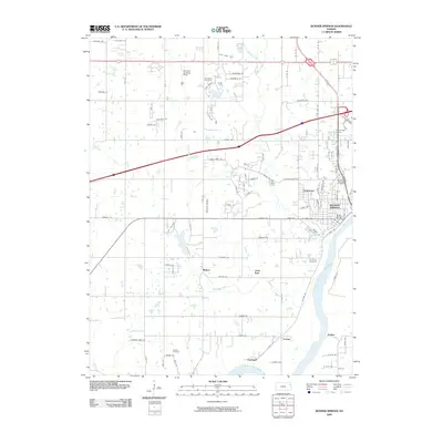
2009 Map of Bonner Springs
USGS Topo · Published 2009About this map
The Kansas River defines the southern edge of this landscape, where the settlements of Loring and Coldspur sit along the riverbank across from Frisbie. This 2009 survey highlights the suburban and industrial growth around Bonner Springs, particularly the concentration of civic and commercial infrastructure like the Bonner Springs Post Office and Northridge Centre. Aviation history is visible through the Bovinair Airport and the Northern Landing Strip, reflecting a mix of general aviation and private airstrips in this part of Wyandotte County. For genealogists, several burial grounds are documented, including Glenwood Cemetery in the north and Lenape Cemetery to the south. Smaller hamlets like Mahon and Little Kaw are situated between the river and the expanding road network, which includes major thoroughfares like Kansas Ave and Wolf Creek Pkwy.
Find a feature on this map
59 named features on this map. Tap any name to fly to it.
Don’t see what you’re looking for? This feature index may not catch every label — zoom into the map to look around manually.
Map Details
Editions of this 2009 Bonner Springs Map
This is the sole edition of this map. No revisions or reprints were ever made.
Other maps of this area

1885 · Lawrence
USGS Topo · 1:125,000

1886 · Oskaloosa
USGS Topo · 1:125,000

1887 · Olathe
USGS Topo · 1:125,000

1888 · Oskaloosa
USGS Topo · 1:125,000

1889 · Lawrence
USGS Topo · 1:125,000

1890 · Kansas City
USGS Topo · 1:125,000

1893 · Olathe
USGS Topo · 1:125,000

1894 · Kansas City
USGS Topo · 1:125,000

1894 · Oskaloosa
USGS Topo · 1:125,000

1934 · Bonner Springs
USGS Topo · 1:48,000