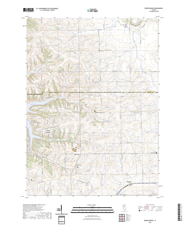
2024 Map of Boone Branch
USGS Topo · Published 2024About this map
Lake Carroll and its surrounding residential developments define the southwestern portion of this landscape, where winding roads like Lake Carroll Blvd and Fawn Ridge Dr trace the shores and nearby hills. The terrain is marked by the distinct transition from the established rural grids of the north to the more modern planned community at the lake. Historically significant sites are scattered throughout the agricultural uplands, including Sabin Cem near W Sabin Church Rd and the Cherry Grove Brethern Cem along the quiet stretch of Harper Rd. Small, local airfields such as Block Airport and Swan Valley Farm Airport hint at the area's ongoing connection to general aviation. Waterways like Boone Branch and Straddle Creek carve through the countryside, framing small settlements like Zier Cors and Kittredge.
Find a feature on this map
68 named features on this map. Tap any name to fly to it.
Don’t see what you’re looking for? This feature index may not catch every label — zoom into the map to look around manually.
Map Details
Editions of this 2024 Boone Branch Map
This is the sole edition of this map. No revisions or reprints were ever made.
Other maps of this area

1937 · Lena
USGS Topo · 1:48,000

1939 · Freeport
USGS Topo · 1:48,000

1942 · Mt Carroll
USGS Topo · 1:62,500

1942 · Lena
USGS Topo · 1:62,500

1942 · Forreston
USGS Topo · 1:62,500

1943 · Lena
USGS Topo · 1:62,500

1944 · Mt Carroll
USGS Topo · 1:62,500

1944 · Freeport
USGS Topo · 1:62,500

1945 · Forreston
USGS Topo · 1:62,500

1954 · Rockford
USGS Topo · 1:250,000