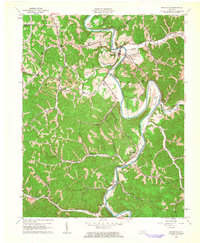
1961 Map of Booneville
USGS Topo · Published 1963About this map
The South Fork Kentucky River meanders through Owsley County, centering on the town of Booneville. In the early 1960s, this landscape was defined by the intersection of traditional Appalachian settlement patterns and emerging industrial activity. The map reveals numerous strip mines and oil wells scattered among the ridges, contrasting with the longstanding social anchors of the region. Local genealogy and history are preserved through named landmarks like Pendergrass Cem and Shepherd Cem, alongside community centers such as Elk Lick Ch and Esau Ch.
Find a feature on this map
50 named features on this map. Tap any name to fly to it.
Don’t see what you’re looking for? This feature index may not catch every label — zoom into the map to look around manually.
Map Details
Editions of this 1961 Booneville Map
3 editions found
Other maps of this area

1891 · Manchester
USGS Topo · 1:125,000

1892 · Beattyville
USGS Topo · 1:125,000

1952 · Tallega
USGS Topo · 1:24,000

1952 · Beattyville
USGS Topo · 1:24,000

1952 · Heidelberg
USGS Topo · 1:24,000

1953 · Oneida
USGS Topo · 1:24,000

1953 · Cowcreek
USGS Topo · 1:24,000

1953 · Mistletoe
USGS Topo · 1:24,000

1953 · Booneville
USGS Topo · 1:24,000

1953 · Sturgeon
USGS Topo · 1:24,000