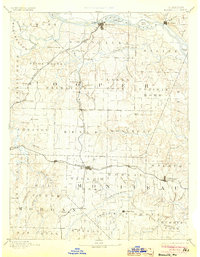
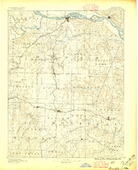
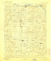
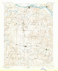
1888 Map of Boonville
USGS Topo · Published 1904About this map
Boonville sits as a critical river port where the Missouri River meets the northern reach of the Missouri Kansas and Texas R. R. in this late 19th-century survey. The landscape is defined by the transition from the river bottomlands, dotted with features like Franklins Island and Diana Island, to the higher agricultural townships of Palestine and Moreau. The Missouri Pacific Railroad cuts a straight path across the southern half of the sheet, connecting bustling central Missouri towns like Tipton, California, and Clarksburg. This era of development is captured in the network of rural post offices and small settlements such as Billingsville, Latham Store, and Pisgah, which served as local hubs before the consolidation of modern transit. The intricate drainage of the Lamine River and Blackwater River further reveals the importance of water access for early central Missouri industry and settlement.
Find a feature on this map
89 named features on this map. Tap any name to fly to it.
Don’t see what you’re looking for? This feature index may not catch every label — zoom into the map to look around manually.
Map Details
Editions of this 1888 Boonville Map
5 editions found
Other maps of this area

1886 · Jefferson City
USGS Topo · 1:125,000

1887 · Sedalia
USGS Topo · 1:125,000

1887 · Warsaw
USGS Topo · 1:125,000

1888 · Versailles
USGS Topo · 1:125,000

1888 · Tuscumbia
USGS Topo · 1:125,000

1888 · Boonville
USGS Topo · 1:125,000

1890 · Moberly
USGS Topo · 1:125,000

1890 · Glasgow
USGS Topo · 1:125,000

1890 · Marshall
USGS Topo · 1:125,000

1892 · Marshall
USGS Topo · 1:125,000