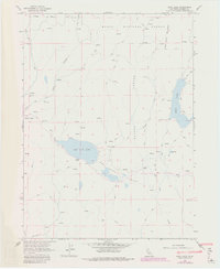
1962 Map of Boot Lake
USGS Topo · Published 1983About this map
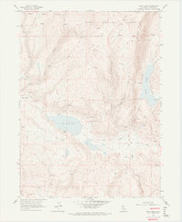
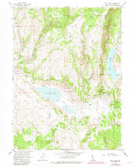
Modoc National Forest encompasses the northern portion of this high-desert landscape, where the seasonal waters of Boot Lake and Red Rock Lake define the valley floors. Ranching and livestock grazing appear as the primary human activity in the early 1960s, evidenced by isolated outposts such as Clarks Valley Ranch, Evans Place, and Hornback Ranch. The area is characterized by its complex hydrology, with numerous unnamed Spring and Springs feeding into drainage systems like Quaking Asp Creek and Selic Creek. A network of Jeep Trails and the Clarks Valley Road provide the only access through the rugged terrain of Alaska Canyon and across the open expanse of Windy Flat. The presence of several vertical angle bench marks, such as VABM Selic 6379 and VABM Black 7824, reflects the detailed geodetic surveying required to map this section of Lassen County.
Find a feature on this map
28 named features on this map. Tap any name to fly to it.
Don’t see what you’re looking for? This feature index may not catch every label — zoom into the map to look around manually.
Map Details
Editions of this 1962 Boot Lake Map
6 editions found
Other maps of this area

1886 · Alturas
USGS Topo · 1:250,000

1886 · Honey Lake
USGS Topo · 1:250,000

1891 · Honey Lake
USGS Topo · 1:250,000

1892 · Alturas
USGS Topo · 1:250,000

1893 · Honey Lake
USGS Topo · 1:250,000

1954 · Observation Peak
USGS Topo · 1:62,500

1954 · Ravendale
USGS Topo · 1:62,500

1954 · Alturas
USGS Topo · 1:250,000

1955 · Westwood
USGS Topo · 1:250,000

1958 · Alturas
USGS Topo · 1:250,000