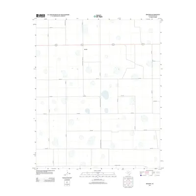
2012 Map of Boothe
USGS Topo · Published 2012About this map
Boothe serves as the focal point of this high-plains landscape in Floyd County, where the geometric precision of Texas agriculture is on full display. The settlement is positioned along Ranch Road 602, which transitions into Farm-To-Market Road 602, illustrating the essential transport corridor that connects this farming community to the wider region. The terrain is defined by a dense network of sectional county roads, including Co Rd-270 and Co Rd-310, which organize the land into vast, productive tracts typical of the Llano Estacado. Small, intermittent depressions dot the landscape, indicating the natural drainage patterns that exist alongside the human-imposed grid. In the southern reach, Ranch Road 1958 provides an east-west artery through this intensely cultivated territory.
Find a feature on this map
20 named features on this map. Tap any name to fly to it.
Don’t see what you’re looking for? This feature index may not catch every label — zoom into the map to look around manually.
Map Details
Editions of this 2012 Boothe Map
This is the sole edition of this map. No revisions or reprints were ever made.
Other maps of this area

1954 · Lubbock
USGS Topo · 1:250,000

1954 · Plainview
USGS Topo · 1:250,000

1958 · Plainview
USGS Topo · 1:250,000

1965 · Lockney SE
USGS Topo · 1:24,000

1965 · Floydada
USGS Topo · 1:24,000

1965 · Floydada SE
USGS Topo · 1:24,000

1965 · Wake
USGS Topo · 1:24,000

1965 · Boothe
USGS Topo · 1:24,000

1966 · Lockney 4 SW
USGS Topo · 1:24,000

1966 · Mount Blanco
USGS Topo · 1:24,000