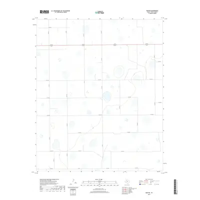
2019 Map of Boothe
USGS Topo · Published 2019About this map
Isolated playa lakes and a sprawling network of farm-to-market roads characterize this section of the High Plains in the late 2010s. The primary east-west corridor is the combined route of 62 70, cutting a straight line across the level landscape. The area is defined by its agricultural grid, with secondary routes like FM 602 and FM 1958 providing the backbone for local transit between rural properties. The landscape is dotted with numerous depressions, many of which are designated as wetlands, indicating the importance of surface water management in this semi-arid region. These natural features contrast with the rigid geometry of the county road system, which includes long stretches of Co Rd 211 and Co Rd 241. This survey provides a clear view of the rural infrastructure and natural drainage patterns used by local landowners and civil engineers.
Find a feature on this map
19 named features on this map. Tap any name to fly to it.
Don’t see what you’re looking for? This feature index may not catch every label — zoom into the map to look around manually.
Map Details
Editions of this 2019 Boothe Map
This is the sole edition of this map. No revisions or reprints were ever made.
Other maps of this area

1954 · Lubbock
USGS Topo · 1:250,000

1954 · Plainview
USGS Topo · 1:250,000

1958 · Plainview
USGS Topo · 1:250,000

1965 · Lockney SE
USGS Topo · 1:24,000

1965 · Floydada
USGS Topo · 1:24,000

1965 · Floydada SE
USGS Topo · 1:24,000

1965 · Wake
USGS Topo · 1:24,000

1965 · Boothe
USGS Topo · 1:24,000

1966 · Lockney 4 SW
USGS Topo · 1:24,000

1966 · Mount Blanco
USGS Topo · 1:24,000