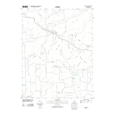
2010 Map of Borden
USGS Topo · Published 2010About this map
The Muddy Fork river valley anchors this portion of Clark County, Indiana, where the town of Borden serves as a central hub for the surrounding rural communities. The landscape is defined by a dense network of hollows and ridges, including Alum Cave Hollow, Breedlove Hollow, and Scott Hollow, reflecting a rugged topography that has historically influenced the placement of roads and farmsteads. Smaller settlements like Starlight, Scottsville, and Navilleton are scattered throughout the southern and eastern reaches, each connected by narrow routes such as Navilleton Rd and Starlight Rd.
Find a feature on this map
101 named features on this map. Tap any name to fly to it.
Don’t see what you’re looking for? This feature index may not catch every label — zoom into the map to look around manually.
Map Details
Editions of this 2010 Borden Map
This is the sole edition of this map. No revisions or reprints were ever made.
Other maps of this area

1938 · Speed
USGS Topo · 1:24,000

1939 · New Albany
USGS Topo · 1:24,000

1939 · Georgetown
USGS Topo · 1:24,000

1941 · Borden
USGS Topo · 1:24,000

1946 · New Albany
USGS Topo · 1:24,000

1947 · Speed
USGS Topo · 1:24,000

1947 · Georgetown
USGS Topo · 1:24,000

1949 · Henryville
USGS Topo · 1:24,000

1949 · Georgetown
USGS Topo · 1:24,000

1950 · Salem
USGS Topo · 1:24,000