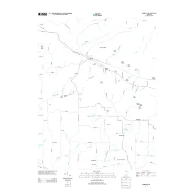
2013 Map of Borden
USGS Topo · Published 2013About this map
Borden serves as the central hub of this Indiana landscape, situated along the winding course of the Muddy Fork. The terrain is defined by a dense network of hills and hollows, where family-named landmarks like Koetter Hollow, Gibson Hollow, and Breedlove Hollow reflect a long history of local land use. To the south, smaller crossroads communities including Scottsville, Navilleton, and Starlight dot the uplands, connected by a web of rural roads such as Stalker Rd and Martinsburg Rd. Hydrological features are prominent, ranging from the Greenville Reservoir to smaller impoundments like Stumbler Lake and Scottsville Lake. The map captures a transition from the narrow valley floor at Mill Hollow to prominent elevations like Daisy Hill and Chestnut Hill, illustrating how the drainage patterns of Souders Br and Fordyce Brook have shaped the region's development and transportation corridors.
Find a feature on this map
129 named features on this map. Tap any name to fly to it.
Don’t see what you’re looking for? This feature index may not catch every label — zoom into the map to look around manually.
Map Details
Editions of this 2013 Borden Map
This is the sole edition of this map. No revisions or reprints were ever made.
Other maps of this area

1938 · Speed
USGS Topo · 1:24,000

1939 · New Albany
USGS Topo · 1:24,000

1939 · Georgetown
USGS Topo · 1:24,000

1941 · Borden
USGS Topo · 1:24,000

1946 · New Albany
USGS Topo · 1:24,000

1947 · Speed
USGS Topo · 1:24,000

1947 · Georgetown
USGS Topo · 1:24,000

1949 · Henryville
USGS Topo · 1:24,000

1949 · Georgetown
USGS Topo · 1:24,000

1950 · Salem
USGS Topo · 1:24,000