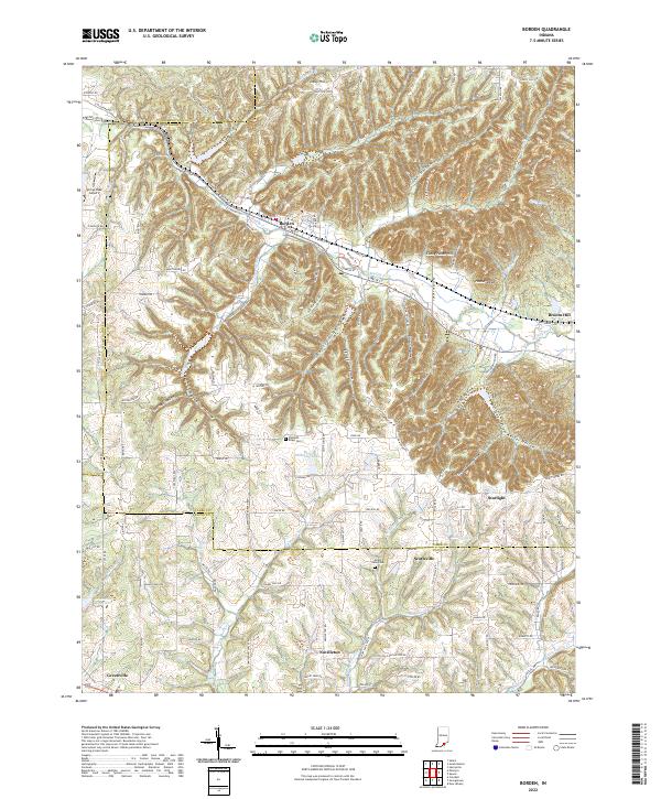
2022 Map of Borden
USGS Topo · Published 2022About this map
Borden sits at the northern edge of this Southern Indiana landscape, where the valley of the Muddy Fork cuts through the uplands. The terrain is defined by a dense network of timbered ravines and hollows, including Koetter Hollow, Burns Hollow, and Hog Hollow, which separate the small agricultural communities from one another. To the south, the settlements of Scottsville and Starlight are established near the Clark and Floyd County boundary, reflecting a long history of rural development along the Highland Rim. Local genealogists will find value in the location of the Pleasant Ridge Cem and Mount Eden Cem, while the inclusion of the Spring Lake Airport and the Greenville Reservoir illustrates the infrastructure supporting these hilltop towns. The mapping of Borden Trl and various township roads provides a clear record of the area's modern connectivity.
Find a feature on this map
94 named features on this map. Tap any name to fly to it.
Don’t see what you’re looking for? This feature index may not catch every label — zoom into the map to look around manually.
Map Details
Editions of this 2022 Borden Map
This is the sole edition of this map. No revisions or reprints were ever made.
Other maps of this area

1938 · Speed
USGS Topo · 1:24,000

1939 · New Albany
USGS Topo · 1:24,000

1939 · Georgetown
USGS Topo · 1:24,000

1941 · Borden
USGS Topo · 1:24,000

1946 · New Albany
USGS Topo · 1:24,000

1947 · Speed
USGS Topo · 1:24,000

1947 · Georgetown
USGS Topo · 1:24,000

1949 · Henryville
USGS Topo · 1:24,000

1949 · Georgetown
USGS Topo · 1:24,000

1950 · Salem
USGS Topo · 1:24,000