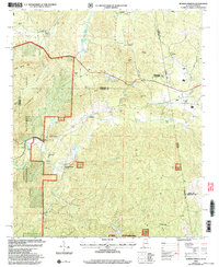
2001 Map of Borden Springs
USGS Topo · Published 2004About this map
Tecumseh Furnace and the neighboring Tecumseh settlement define the northern industrial history of this area near the Alabama-Georgia border. These points of interest sit at the base of Baker Hill and Gobler Knob, marking a landscape where early manufacturing met the foothills of the Appalachian range. Further south, the community of Borden Springs and the Borden Wheeler Springs area highlight a legacy of mineral springs and rural gathering places.
Find a feature on this map
50 named features on this map. Tap any name to fly to it.
Don’t see what you’re looking for? This feature index may not catch every label — zoom into the map to look around manually.
Map Details
Editions of this 2001 Borden Springs Map
This is the sole edition of this map. No revisions or reprints were ever made.
Other maps of this area

1886 · Rome
USGS Topo · 1:125,000

1889 · Tallapoosa
USGS Topo · 1:125,000

1892 · Tallapoosa
USGS Topo · 1:125,000

1893 · Fort Payne
USGS Topo · 1:125,000

1897 · Tallapoosa
USGS Topo · 1:125,000

1898 · Rome
USGS Topo · 1:125,000

1898 · Fort Payne
USGS Topo · 1:125,000

1899 · Rome
USGS Topo · 1:125,000

1900 · Fort Payne
USGS Topo · 1:125,000

1900 · Anniston
USGS Topo · 1:125,000