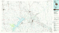
1986 Map of Borger
USGS Topo · Published 1986About this map
Lake Meredith National Recreation Area dominates the central landscape of this Texas Panhandle survey, where the impounded Canadian River cuts through the high plains. The region's mid-century industrial identity is clearly mapped through the expansive Oil and Gas Field and the Dial Oil Field, supporting settlements like Borger, Phillips, and Electric City. For the local historian, the map preserves the locations of several company housing sites and smaller settlements such as Supreme Camp, Crescent Camp, and Stegall Camp that once housed the energy workforce.
Find a feature on this map
77 named features on this map. Tap any name to fly to it.
Don’t see what you’re looking for? This feature index may not catch every label — zoom into the map to look around manually.
Map Details
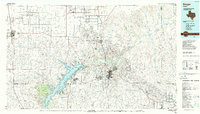
Editions of this 1986 Borger Map
2 editions found
Other maps of this area

1934 · Ady
USGS Topo · 1:62,500

1934 · Cliffside
USGS Topo · 1:62,500

1936 · Fourways
USGS Topo · 1:62,500

1936 · Cliffside
USGS Topo · 1:62,500

1936 · Ady
USGS Topo · 1:62,500

1939 · Sanford
USGS Topo · 1:62,500

1953 · Sanford
USGS Topo · 1:24,000

1953 · Plemons
USGS Topo · 1:24,000

1953 · Chunky
USGS Topo · 1:24,000

1953 · Marsh
USGS Topo · 1:24,000