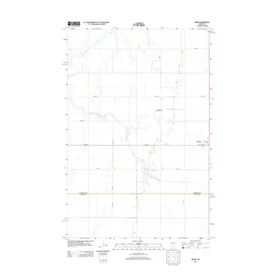
2013 Map of Borup
USGS Topo · Published 2013About this map
Borup sits at a crossroads of the Red River Valley, where the grid of the northern plains meets the meandering course of the Wild Rice River. This 2013 survey captures the agricultural landscape along the border of Norman Co and Clay Co, defined by long, straight roads like 160th Ave and Main Ave. The map reflects the community's established roots through legacy sites such as the Winchester Cem and the German Methodist Cem, markers of early settlement and the area's denominational history. Water management and natural drainage are evident in the winding South Branch Wild Rice River, which breaks the otherwise uniform township and range sections. The concentration of local services in the village is represented by the Po, serving as a central point for the surrounding farming region.
Find a feature on this map
18 named features on this map. Tap any name to fly to it.
Don’t see what you’re looking for? This feature index may not catch every label — zoom into the map to look around manually.
Map Details
Editions of this 2013 Borup Map
This is the sole edition of this map. No revisions or reprints were ever made.
Other maps of this area

1918 · Twin Valley
USGS Topo · 1:62,500

1918 · Ulen
USGS Topo · 1:62,500

1924 · Ada
USGS Topo · 1:62,500

1952 · Grand Forks
USGS Topo · 1:250,000

1956 · Grand Forks
USGS Topo · 1:250,000

1965 · Anthony
USGS Topo · 1:24,000

1965 · Twin Valley SW
USGS Topo · 1:24,000
1965 · Ada
USGS Topo · 1:24,000
1965 · Ulen NW
USGS Topo · 1:24,000

1966 · Grand Forks
USGS Topo · 1:250,000