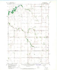
1966 Map of Borup
USGS Topo · Published 1967About this map
Borup sits at the intersection of a central transportation corridor in the mid-1960s, anchored by the Great Northern railroad line. The landscape is defined by the transition from the winding course of the Wild Rice River and its South Branch to a highly engineered drainage system. This network of man-made waterways, including County Ditch No 12 and Judicial Ditch No 56, reveals the extensive efforts to manage the Red River Valley’s flat terrain for agricultural production.
Find a feature on this map
18 named features on this map. Tap any name to fly to it.
Don’t see what you’re looking for? This feature index may not catch every label — zoom into the map to look around manually.
Map Details
Editions of this 1966 Borup Map
This is the sole edition of this map. No revisions or reprints were ever made.
Other maps of this area

1918 · Twin Valley
USGS Topo · 1:62,500

1918 · Ulen
USGS Topo · 1:62,500

1924 · Ada
USGS Topo · 1:62,500

1952 · Grand Forks
USGS Topo · 1:250,000

1956 · Grand Forks
USGS Topo · 1:250,000

1965 · Anthony
USGS Topo · 1:24,000

1965 · Twin Valley SW
USGS Topo · 1:24,000
1965 · Ada
USGS Topo · 1:24,000
1965 · Ulen NW
USGS Topo · 1:24,000

1966 · Grand Forks
USGS Topo · 1:250,000