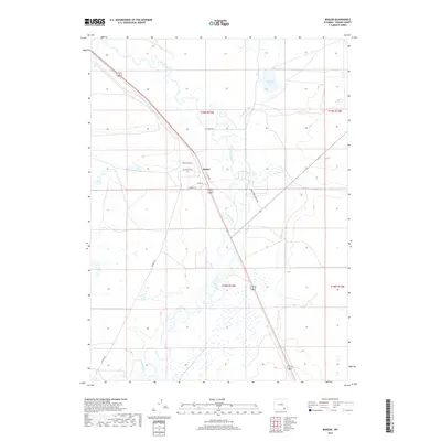
2017 Map of Bosler
USGS Topo · Published 2017About this map
Bosler serves as the central hub of this Albany County landscape, where the high plains meet a sophisticated network of water management. The Laramie River meanders through the center of the sheet, its natural course supplemented by the Boughton Canal and the Oasis Canal, reflecting the region's long-standing reliance on irrigation for ranching and agriculture. The settlement of Bosler itself is depicted with a clear street grid, including Rosecrans Ave and Tallmadge Ave, adjacent to the primary north-south highway corridor. To the northeast, the expanse of Diamond Lake provides a significant hydrological marker in an otherwise arid terrain defined by subtle elevation changes. This survey illustrates the persistent ranching infrastructure of the early 21st century, with large rural tracts connected by routes like Iron Horse Ranch Rd and Howell Rd.
Find a feature on this map
16 named features on this map. Tap any name to fly to it.
Don’t see what you’re looking for? This feature index may not catch every label — zoom into the map to look around manually.
Map Details
Editions of this 2017 Bosler Map
This is the sole edition of this map. No revisions or reprints were ever made.
Other maps of this area

1895 · Laramie
USGS Topo · 1:125,000

1902 · Laramie
USGS Topo · 1:125,000

1905 · Laramie
USGS Topo · 1:125,000

1906 · Laramie
USGS Topo · 1:125,000

1908 · Laramie
USGS Topo · 1:125,000

1954 · Cheyenne
USGS Topo · 1:250,000

1955 · Bosler
USGS Topo · 1:24,000

1955 · Bosler SE
USGS Topo · 1:24,000

1955 · Cooper Lake South
USGS Topo · 1:24,000

1955 · Sybille Springs
USGS Topo · 1:24,000