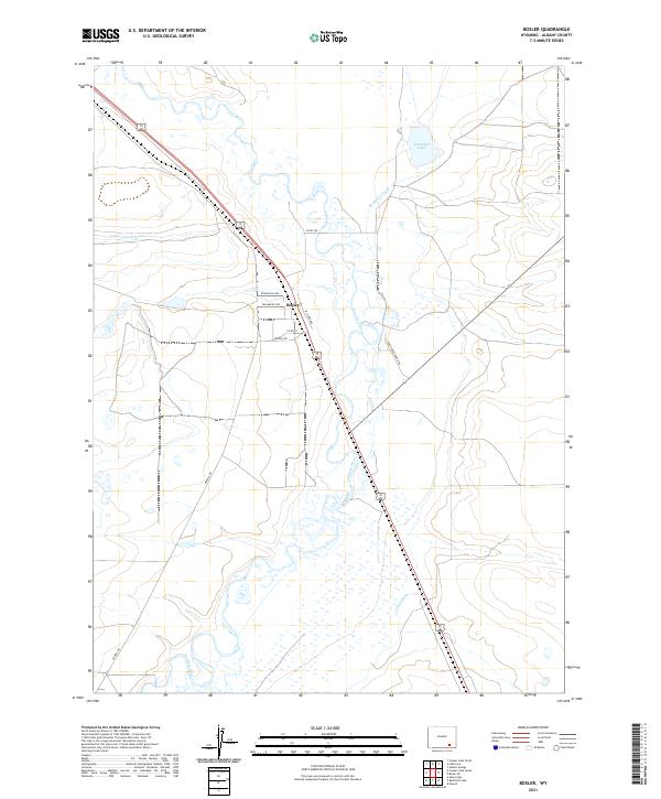
2021 Map of Bosler
USGS Topo · Published 2021About this map
The Laramie River meanders through the heart of the Laramie Plains in this section of Albany County, defining a landscape shaped by high-altitude ranching and early irrigation systems. The small settlement of Bosler serves as a focal point, situated at the junction of US Route 30 287 and local thoroughfares like Tallmadge Ave and W Clark Ave. The reliance on water management in this arid environment is evident in the intricate network of the Boughton Canal, James Lake N Canal, and Oasis Ditch. These waterways, alongside Diamond Lake, highlight the human effort to sustain agriculture and livestock in the Wyoming basin. Traces of local landownership and rural development are visible through named routes such as Iron Horse Ranch Rd and Howell Rd, which connect the isolated homesteads and pastures of the surrounding townships.
Find a feature on this map
17 named features on this map. Tap any name to fly to it.
Don’t see what you’re looking for? This feature index may not catch every label — zoom into the map to look around manually.
Map Details
Editions of this 2021 Bosler Map
This is the sole edition of this map. No revisions or reprints were ever made.
Other maps of this area

1895 · Laramie
USGS Topo · 1:125,000

1902 · Laramie
USGS Topo · 1:125,000

1905 · Laramie
USGS Topo · 1:125,000

1906 · Laramie
USGS Topo · 1:125,000

1908 · Laramie
USGS Topo · 1:125,000

1954 · Cheyenne
USGS Topo · 1:250,000

1955 · Bosler
USGS Topo · 1:24,000

1955 · Bosler SE
USGS Topo · 1:24,000

1955 · Cooper Lake South
USGS Topo · 1:24,000

1955 · Sybille Springs
USGS Topo · 1:24,000