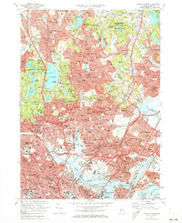
1971 Map of Boston North
USGS Topo · Published 1973About this map
Dense urban development and historic preserves characterize the region north of Boston during the early 1970s. The map illustrates a landscape where industrial infrastructure and major transit corridors like the MBTA System and Penn Central RR wrap around significant green spaces. The Middlesex Fells Reservation dominates the western portion, containing numerous reservoirs and named peaks such as Bear Hill and Winthrop Hill. To the east, the Saugus River meanders toward the Seaplane Basin and Logan International Airport. Genealogists and local historians will find numerous landmarks of the era, from the Saugus Ironworks National Historic Site to the concentration of academic institutions including Harvard University and Tufts University. The map also captures the layout of established neighborhoods in Malden, Melrose, and Everett, along with expansive memorial sites like Holy Cross Cemetery and the US Naval Hospital on the waterfront.
Find a feature on this map
190 named features on this map. Tap any name to fly to it.
Don’t see what you’re looking for? This feature index may not catch every label — zoom into the map to look around manually.
Map Details
Editions of this 1971 Boston North Map
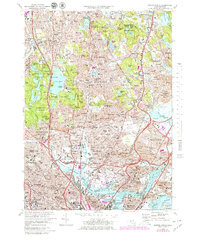
2 editions found
Other maps of this area

1886 · Lawrence
USGS Topo · 1:62,500

1888 · Lawrence
USGS Topo · 1:62,500

1888 · Salem
USGS Topo · 1:62,500

1892 · Boston Bay
USGS Topo · 1:62,500

1893 · Salem
USGS Topo · 1:62,500

1893 · Boston
USGS Topo · 1:62,500

1893 · Lawrence
USGS Topo · 1:62,500

1903 · Boston
USGS Topo · 1:62,500

1903 · Boston Bay
USGS Topo · 1:62,500

1917 · Salem
USGS Topo · 1:62,500