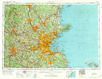
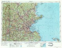
1956 Map of Boston
USGS Topo · Published 1971About this map
The Merrimack River and Charles River define the industrial and residential corridors of this mid-century New England landscape. Heavily urbanized hubs like Boston, Worcester, and Lowell appear at a peak of post-war density, interconnected by the established routes of the Boston & Maine RR and the burgeoning suburban network of Mass. 128. This 1956 survey captures the region just as the interstate era was reshaping travel, evidenced by the prominence of major air installations such as Hanscom AFB and Weymouth Nas. To the north, the Unconoonuc Mountains rise near Manchester, while the coastal landscape remains dominated by the Massachusetts Bay and the recently established Cape Cod National Seashore. The map preserves the footprint of several state forests and military reserves, including Fort Devens Mil Res, reflecting a landscape balanced between dense metropolitan growth and preserved wilderness.
Find a feature on this map
207 named features on this map. Tap any name to fly to it.
Don’t see what you’re looking for? This feature index may not catch every label — zoom into the map to look around manually.
Map Details
Editions of this 1956 Boston Map
6 editions found

Other maps of this area

1885 · Abington
USGS Topo · 1:62,500

1885 · Duxbury
USGS Topo · 1:62,500

1885 · Worcester
USGS Topo · 1:62,500

1885 · Middleboro
USGS Topo · 1:62,500

1885 · Taunton
USGS Topo · 1:62,500

1886 · Gloucester
USGS Topo · 1:62,500

1886 · Lawrence
USGS Topo · 1:62,500

1886 · Worcester
USGS Topo · 1:62,500

1886 · Blackstone
USGS Topo · 1:62,500

1886 · Plymouth
USGS Topo · 1:62,500