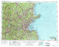
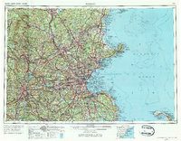
1956 Map of Boston
USGS Topo · Published 1974About this map
Boston and its sprawling coastal neighbors anchor this mid-century view of the Massachusetts and New Hampshire shoreline. The industrial corridor stretching from Lowell and Lawrence up to Nashua and Manchester is clearly defined by the Merrimack River and the extensive tracks of the Boston and Maine railroad. Along the coast, the map details the intricate geography of Massachusetts Bay, from the protective curve of Cape Ann down to the early footprint of the Cape Cod National Seashore.
Find a feature on this map
147 named features on this map. Tap any name to fly to it.
Don’t see what you’re looking for? This feature index may not catch every label — zoom into the map to look around manually.
Map Details
Editions of this 1956 Boston Map
6 editions found

Other maps of this area

1885 · Abington
USGS Topo · 1:62,500

1885 · Duxbury
USGS Topo · 1:62,500

1885 · Worcester
USGS Topo · 1:62,500

1885 · Middleboro
USGS Topo · 1:62,500

1885 · Taunton
USGS Topo · 1:62,500

1886 · Gloucester
USGS Topo · 1:62,500

1886 · Lawrence
USGS Topo · 1:62,500

1886 · Worcester
USGS Topo · 1:62,500

1886 · Blackstone
USGS Topo · 1:62,500

1886 · Plymouth
USGS Topo · 1:62,500