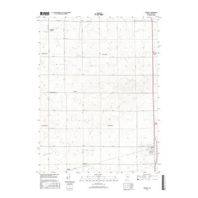
2016 Map of Boswell
USGS Topo · Published 2016About this map
Boswell anchors the southeast corner of this western Benton County landscape, where the grid of rural life is defined by a dense network of agricultural waterways and county roads. The drainage systems, including Gretencord Ditch, Finigan Ditch, and Kult Ditch, reflect a highly managed prairie environment engineered for productivity. Small, established settlements such as Freeland Park and Dunnington are scattered across the northern sections, while Talbot and Handy occupy the southern reaches near the N Fork Vermilion River. The map provides a detailed look at the local street plan of Boswell, showing arterial connections like S Center St and S Adams St. This region, characterized by its rectangular survey blocks and precise section lines, illustrates the enduring spatial organization of the Indiana countryside in the early twenty-first century.
Find a feature on this map
41 named features on this map. Tap any name to fly to it.
Don’t see what you’re looking for? This feature index may not catch every label — zoom into the map to look around manually.
Map Details
Editions of this 2016 Boswell Map
This is the sole edition of this map. No revisions or reprints were ever made.
Other maps of this area

1933 · Hoopeston
USGS Topo · 1:48,000

1938 · Milford
USGS Topo · 1:48,000

1938 · Hoopeston
USGS Topo · 1:62,500

1944 · Milford
USGS Topo · 1:62,500

1953 · Danville
USGS Topo · 1:250,000

1955 · Danville
USGS Topo · 1:250,000

1956 · Danville
USGS Topo · 1:250,000

1961 · Tab
USGS Topo · 1:24,000

1961 · Pine Village
USGS Topo · 1:24,000

1962 · Wadena
USGS Topo · 1:24,000