2022 Map of Boswell
USGS Topo · Published 2022About this map
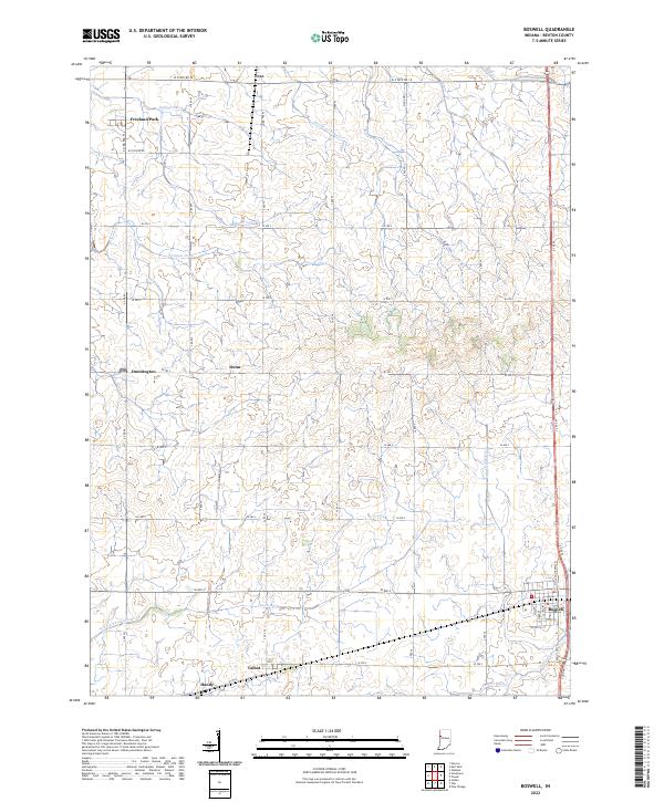
Boswell and the surrounding agricultural landscape of Benton County are defined by an intricate network of drainage systems essential to this region's fertile prairie soil. The town of Boswell sits in the southeast corner, where the local street grid including W South St meets N Old US Highway 41. To the west, small rural settlements and siding locations like Talbot, Handy, and Dunn line the southern corridor, reflecting the historic influence of regional transportation on these plains. Water management is the dominant topographic feature, with named channels such as Salmon Ditch, Gretencord Ditch, and Leuck Ditch lacing across the township lines. The headwaters of the N Fork Vermilion River begin to take shape in the southwest, while Goose Cr and Mud Cr touch the map's eastern and northern boundaries, illustrating the hydrology of this high-productivity farming heartland.
Find a feature on this map
37 named features on this map. Tap any name to fly to it.
Don’t see what you’re looking for? This feature index may not catch every label — zoom into the map to look around manually.
Map Details
Editions of this 2022 Boswell Map
This is the sole edition of this map. No revisions or reprints were ever made.