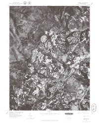
1977 Map of Boswell
USGS Topo · Published 1979About this map
Boswell and the surrounding Somerset County landscape are captured in this 1977 orthophotograph, revealing the distinct agricultural and residential patterns of the late 1970s. The imagery highlights the winding path of Quemahoning Creek as it flows past the borough of Boswell, which shows a dense, organized street grid characteristic of Pennsylvania's coal and industrial towns. In the western portion of the map, Jennerstown sits at a prominent crossroads, serving as a local hub for the surrounding rural communities of Jenners Crossroads and Ferrellton. The high-contrast aerial photography provides a clear view of strip-cropped fields and woodlots, illustrating the land-use transitions between these small settlements. For researchers, this document offers a precise visual record of the built environment and rural topography before decades of subsequent development altered the regional footprint.
Find a feature on this map
5 named features on this map. Tap any name to fly to it.
Don’t see what you’re looking for? This feature index may not catch every label — zoom into the map to look around manually.
Map Details
Editions of this 1977 Boswell Map
This is the sole edition of this map. No revisions or reprints were ever made.
Other maps of this area

1904 · Johnstown
USGS Topo · 1:62,500

1907 · Johnstown
USGS Topo · 1:62,500

1913 · Somerset
USGS Topo · 1:62,500

1914 · Windber
USGS Topo · 1:62,500

1915 · Somerset
USGS Topo · 1:62,500

1916 · Windber
USGS Topo · 1:62,500

1920 · New Florence
USGS Topo · 1:62,500

1921 · New Florence
USGS Topo · 1:48,000

1922 · New Florence
USGS Topo · 1:62,500

1944 · Somerset
USGS Topo · 1:62,500