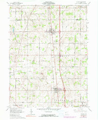
1961 Map of Botkins
USGS Topo · Published 1990About this map
The village of Botkins serves as a central hub on this landscape, bisected by the Baltimore and Ohio railroad corridor. This mid-century survey reflects a deeply rooted agrarian community, where landmarks like the Fish Hatchery and several rural burial grounds including Old Loramie Valley Cem and New Loramie Valley Cem provide specific points of interest for genealogists and local historians. The map is notably bisected by the historic Greenville Treaty Line in the southern portion, a reminder of early frontier surveying that still shaped property boundaries into the 1960s.
Find a feature on this map
40 named features on this map. Tap any name to fly to it.
Don’t see what you’re looking for? This feature index may not catch every label — zoom into the map to look around manually.
Map Details
Editions of this 1961 Botkins Map
Other maps of this area

1906 · Lima
USGS Topo · 1:62,500

1909 · Loramie
USGS Topo · 1:62,500

1911 · Loramie
USGS Topo · 1:62,500

1911 · Spencerville
USGS Topo · 1:62,500

1913 · Sidney
USGS Topo · 1:62,500

1944 · Sidney
USGS Topo · 1:62,500

1944 · Loramie
USGS Topo · 1:62,500

1944 · Spencerville
USGS Topo · 1:62,500

1953 · Muncie
USGS Topo · 1:250,000

1956 · Muncie
USGS Topo · 1:250,000