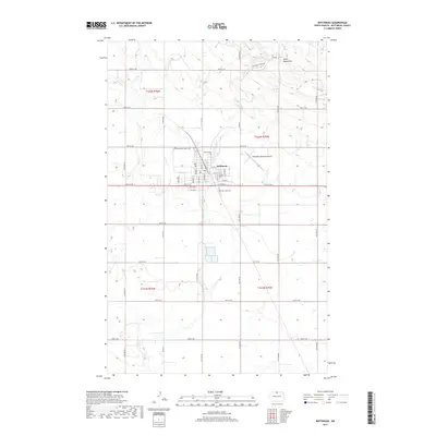
2017 Map of Bottineau
USGS Topo · Published 2017About this map
Bottineau serves as the focal point for this north-central North Dakota landscape, where the prairie meets the rising slopes of the Turtle Mountains. The city's grid is well-defined, showing the core residential and commercial streets such as Main St and Vinje St, alongside educational landmarks like Dakota Coll. This modern topographical study illustrates a transition from the structured township blocks of the plains to the more irregular, elevated terrain in the northeast corner of the quadrangle. Local history is anchored by the presence of Mount Saint Mark Cem and Oak Creek Cem, while water systems like Oak Cr and Stone Cr drain the surrounding agricultural lands. The infrastructure of the region is further represented by the Bottineau Municipal Airport, situated just east of the main settlement.
Find a feature on this map
48 named features on this map. Tap any name to fly to it.
Don’t see what you’re looking for? This feature index may not catch every label — zoom into the map to look around manually.
Map Details
Editions of this 2017 Bottineau Map
This is the sole edition of this map. No revisions or reprints were ever made.
Other maps of this area

1954 · Omemee
USGS Topo · 1:24,000

1954 · Souris SE
USGS Topo · 1:24,000

1954 · Gardena
USGS Topo · 1:24,000

1954 · Minot
USGS Topo · 1:250,000
1955 · Upham NE
USGS Topo · 1:24,000

1955 · Bottineau
USGS Topo · 1:24,000

1955 · Bottineau SE
USGS Topo · 1:24,000

1956 · Metigoshe Lake
USGS Topo · 1:24,000

1956 · Carbury
USGS Topo · 1:24,000

1956 · Lake McArthur
USGS Topo · 1:24,000