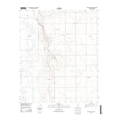
2013 Map of Bottomless Lakes
USGS Topo · Published 2013About this map
The Pecos River valley defines this Chaves County landscape, where groundwater seepage has created a string of distinctive cenotes. The Bottomless Lakes area features a chain of sinkhole water bodies including Lea Lake, Cottonwood Lake, and the small Inkwell Lake. The topography illustrates the sharp contrast between the river's flood plain to the west and the rising desert bluffs to the east. Several local cattle operations and homesteads, such as Ervin Ranch and Atkinson Ranch, dot the plains, connected by a network of ranch roads including Marie RD and Juliet RD. The presence of the Hagerman Canal and Comanche Draw highlights the vital role of water management in this arid region, where the sinkholes provided rare permanent water sources for travelers and livestock alike.
Find a feature on this map
68 named features on this map. Tap any name to fly to it.
Don’t see what you’re looking for? This feature index may not catch every label — zoom into the map to look around manually.
Map Details
Editions of this 2013 Bottomless Lakes Map
This is the sole edition of this map. No revisions or reprints were ever made.
Other maps of this area

1949 · Wade Ranch
USGS Topo · 1:24,000

1949 · L-E Ranch
USGS Topo · 1:24,000

1950 · Dexter West
USGS Topo · 1:24,000

1950 · Comanche Spring
USGS Topo · 1:24,000

1950 · Bottomless Lakes
USGS Topo · 1:24,000

1950 · South Spring
USGS Topo · 1:24,000

1950 · Bitter Lake
USGS Topo · 1:24,000

1950 · Dexter East
USGS Topo · 1:24,000

1952 · Bar C Bar Ranch
USGS Topo · 1:24,000

1955 · Roswell
USGS Topo · 1:250,000