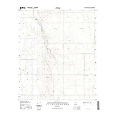
2017 Map of Bottomless Lakes
USGS Topo · Published 2017About this map
Bottomless Lakes cluster along a dramatic escarpment east of the Pecos River, where sinkholes have formed deep cenotes in the Chaves County landscape. This 2017 survey shows the intricate hydrology of the area, ranging from the prominent Lea Lake and Dimmitt Lake to the smaller, distinctive formations of Inkwell Lake and Figure Eight Lake. The contrast between the river's winding path and the stationary deep-blue basins of the lakes highlights the unique geological activity of the region.
Find a feature on this map
30 named features on this map. Tap any name to fly to it.
Don’t see what you’re looking for? This feature index may not catch every label — zoom into the map to look around manually.
Map Details
Editions of this 2017 Bottomless Lakes Map
This is the sole edition of this map. No revisions or reprints were ever made.
Other maps of this area

1949 · Wade Ranch
USGS Topo · 1:24,000

1949 · L-E Ranch
USGS Topo · 1:24,000

1950 · Dexter West
USGS Topo · 1:24,000

1950 · Comanche Spring
USGS Topo · 1:24,000

1950 · Bottomless Lakes
USGS Topo · 1:24,000

1950 · South Spring
USGS Topo · 1:24,000

1950 · Bitter Lake
USGS Topo · 1:24,000

1950 · Dexter East
USGS Topo · 1:24,000

1952 · Bar C Bar Ranch
USGS Topo · 1:24,000

1955 · Roswell
USGS Topo · 1:250,000